
Yoyogi Park
Yoyogi Park 10K Running Route
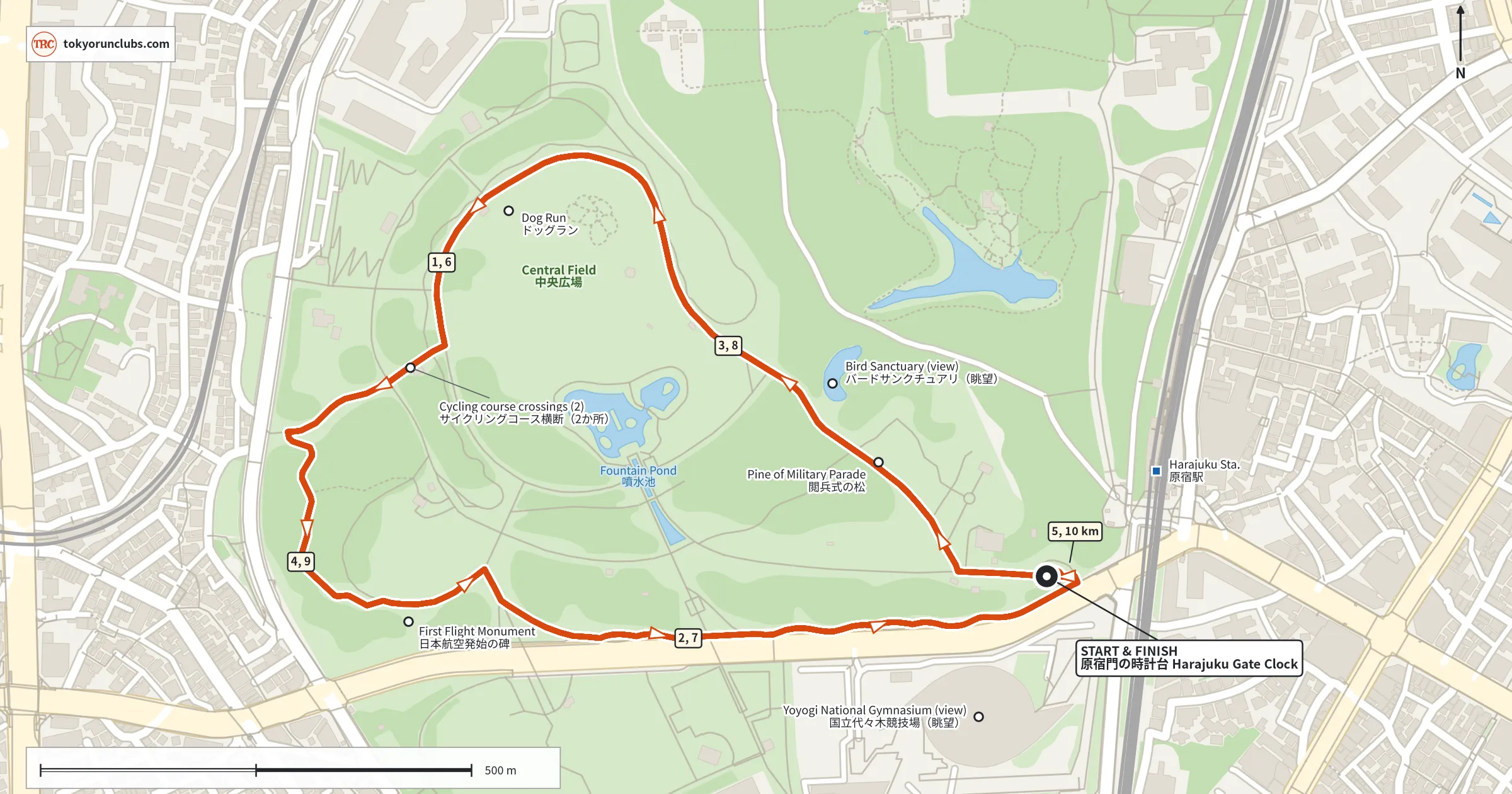
A mostly flat, paved 10K in Yoyogi Park. Run four 2.5 km laps from the Harajuku Gate clock, around the Central Field and through the shaded western woods.
- 10.1 km
- 4 laps
- Mostly paved
Getting there
Start at the round patterned plaza by the clock tower, just outside Harajuku Gate. It is about three minutes on foot from the West Exit of JR Harajuku Station or Exit 2 of Meiji-jingumae Station. Each 2.5 km lap ends back at the clock, so it is easy to count laps or stop early.
On the run
Run counterclockwise with the Central Field on your left, past the Pine of Military Parade and around the north end of the field by the Dog Run. On the west side, the path drops into a shaded grove and winds back up past the First Flight Monument, which marks Japan’s first powered flight in 1910. It is the only climb of the lap, adding up to about 70 m over four laps. Each lap returns along the park’s southern edge, with the roof of Yoyogi National Gymnasium across the road.
For a shorter run, two laps of the same loop make our 5K route.
How long it takes
Estimated finish times for the full route.
- 5:00 /km
- 50:19
- 6:00 /km
- 1:00:23
- 7:00 /km
- 1:10:26
- 8:00 /km
- 1:20:30